Cemetery mapping solutions designed for local councils

Private Crematoria

For private crematoria

District Councils Cemetery Map

For district councils

For natural and woodland burial grounds

Cemetery mapping solutions designed for you

Why choose a Pear Cemetery Map?

A Pear cemetery map is created using the latest and most reliable data sources available, from Ordnance Survey data to aerial imagery, GPS and existing paper maps. Our experience and expertise in this sector means our cemetery mapping services are both accurate and affordable. 

  • High Quality

    Based on Ordnance Survey Mastermap Topography Layer our cemetery maps are incredibly accurate.

  • Experienced

    Pear Technology have been creating cemetery maps since 1999.

  • Knowledgable

    Pear are an Associate Corporate member of the Institute of Cemetery and Crematorium Management (ICCM).

  • Affordable

    Ask us for a quote – our cemetery maps are not only highly accurate, but are also some of the most affordable on the market.

  • Compatible

    Maps can be linked to Pear’s own burial database, or existing cemetery management systems.

  • Supported

    Our friendly and knowledgeable UK based support team will be there to help you out should you need it.

Typical Uses

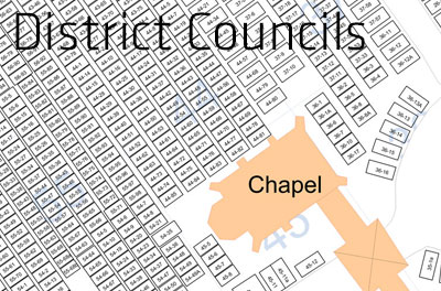
  • Local and District Council Cemeteries and Burial Grounds
  • Churchyards
  • Private Cemeteries and Crematoria
  • Natural and Woodland Burial Grounds
ICCM Associate Logo

We now have an accurate map and confidence that the graves are correctly located. Support and communication from Pear were excellent.

All three of the council’s cemeteries required mapping as part of the digitisation project. The mapping process is very straightforward and Pear were extremely professional and helpful. Having the burial records and details of all our cemeteries at my fingertips has been well worth the cost and effort involved and will prevent any mistakes being made.

The addition of the Cemetery Searcher map to our website provides free searchable information which can be accessed from anywhere. We’re pleased to be able to offer this service which we hope will be of benefit to family history researchers, genealogists and others with an interest in the Town Cemetery.

The Cemetery software has made a vast improvement to the way in which we manage our cemetery records. It saves time searching for information on the plots and their location. It holds the data all in one place including memorial details and is simple to use.

Monk Hesleden Parish Council has used Pear Technology’s Mapping Software for several years and has found it to be an invaluable tool.  The software enables us to produce maps needed for projects/maintenance/recording assets and we have Cemetery Searcher, which is linked to our website and provides members of the public to search for family graves.

The support provided by Pear is first class, especially for those of us who are less confident with technology!

We are delighted with our HeritEDGE map. It has useful functionality and is extremely easy to use. It not only helps with the administration of the cemetery by seamlessly linking to Epitaph but by adding a link to our website the public can use it to search for relatives or locate graves quickly and simply. It really is a great asset!

The Process

Original Paper MapInteractive Digital Map
  • Step 1

    Gathering the data

    Photographs or scans are made of the existing cemetery maps and are sent to Pear Technology.

  • Step 2

    Evaluating the Data

    If needed Pear can visit the site and survey cemetery paths and other key features using highly accurate GPS handhelds.

  • Step 3

    Creating the First Draft

    Pear begin mapping the cemetery using Ordnance Survey’s premium OS Mastermap Topography Data. Google Earth is used to gain additional information about the site.

  • Step 4

    The Draft Process

    Large paper prints are posted to the cemetery to be checked. Pear clearly note on the map any areas that may need investigation.

  • Step 5

    Finalising the Map

    After a few drafts the map is agreed to be correct and is finalised.

  • Step 6

    Set Up

    The map is installed and linked to the burial records, or set up online. Pear maps can be linked with various burial administration systems from other providers.

  • Step 7

    Amendments

    We understand that cemeteries grow and change and, to keep your map accurate, Pear offer an optional map maintenance service.

Cemetery Searcher

Cemetery Searcher is a new and unique online burial records search facility linked to an interactive map. It allows members of the public to search records for loved ones and locate their graves on a map.

The GPS Locate feature enables visitors to the cemetery to easily locate graves when viewing the map on their smartphone.

Click here to visit Higham Ferrers Town Council’s Cemetery Searcher

Pear cemetery maps link to these Burial Administration Systems

Case Studies

Henley on Thames Town Council’s Online Interactive Cemetery Map: HeritEdge

Henley-on-Thames Town Council needed to update its outdated cemetery mapping and record-keeping. Discover how Pear Technology and Edge IT Systems delivered a comprehensive, integrated digital solution. This case study details how they achieved highly accurate grave locations by creating a new, publicly accessible cemetery map with both Ordnance Survey and aerial imagery options, which also led to identifying 1,410 new plots, significantly improving efficiency and service for their community.

Find out how they transformed their operations – read the full case study!

Ross-on-Wye Town Council’s Online Interactive Cemetery Map: Cemetery Searcher

Ross-on-Wye Town Council sought to enhance public access to their burial records. Discover how Pear Technology’s “Cemetery Searcher” provided a seamless digital solution. This case study illustrates how their new online map and search facility allows precise grave location via smartphone, and instant access to records, significantly benefiting family historians and visitors alike.

Explore the full case study and see it in action!

Higham Ferrers Town Council’s Online Interactive Cemetery Map: Cemetery Searcher

Higham Ferrers Town Council faced challenges with outdated, inaccurate paper records for their cemetery. Discover how Pear Technology revolutionised their operations with a digital mapping and database solution. This case study reveals how they dramatically cut search times, gained precise record-keeping, and empowered public online grave location, significantly enhancing efficiency and service.

Read their story here!

Alne Wood Park: Interactive Online Natural Burial Ground Map

Discover how Alne Wood Park Natural Burial Ground moved beyond outdated paper systems to embrace a cutting-edge interactive mapping solution. This case study reveals how integrated digital tools now enable precise plot management, streamline operations, and provide visitors with effortless grave location via smartphone. The map links to Edge IT Systems burial records software, Epitaph and HeritEDGE.

Find out more about their success and the technology that made it possible!

FAQ

Register to Download

    Email (required)

    Name (required)

    Organisation

    [mailpoetsignup mailpoetsignup-943 mailpoet_list_4 default:on]

    ×
    Sign up for our newsletter

    Interested in how mapping can help you? Sign up for our occasional newsletter about how people are using maps for land and asset management.

    ×
    Take a tour

    ×
    Register to Download

    Enter your details below to receive an email with download links.

    ×
    Data Sets
    ×
    Ordnance Survey Data in Pear Products

    MasterMap

    ×
    Land Registry Data in Pear Products

    ×
    Rural Payments Agency Data in Pear Products

    ×
    INSPIRE Data in Pear Products

    ×
    Register Interest

    Please enter your details below to register your interest in Map Shop.

    ×
    Register Interest

    Please enter your details below to register your interest in PearGIS. [wysija_form id=”5″]

    ×
    PearGIS Trial

    Enter your details below to receive an email with download links.

    ×