New interactive online natural burial ground map enables Alne Wood Park to effectively manage sale of new plots.
The new interactive online natural burial ground map enables visitors to the burial ground and management to easily locate loved ones resting places. Visitors can now access the site on their smartphone, search records and use the GPS tool to walk to the grave. Plots on the map are styled so that the status of a plot can easily be determined, showing whether it’s available, used or pre-reserved.
The Challenge: Outgrowing Manual Systems
Alne Wood Park Natural Burial Ground is a peaceful 12-acre wildflower meadow established in 2012. The site offers a less formal, nature-friendly alternative to a traditional cemetery for full-burial and also the interment of cremated ashes.
The site is owned by the Heart of England Forest charity. When their founder, Felix Dennis died in 2014, the day-to-day running was subcontracted to a local funeral director. As relatively few burials were conducted, plot sales and their use was managed using a paper-based plan of the site and spreadsheet.
In 2023, the Heart of England Forest took over direct management of the site again and James Booth was employed to manage both the grounds and the business side of the operation. James quickly realised that the current method would become difficult to manage as the site was developed and demand increased. A more robust system was needed to keep records, record positions, measure plots onsite and keep a publicly accessible burial register and map.
After researching the various options, James contacted Pear Technology and Edge IT Systems, who have great experience and expertise in creating burial ground maps and linking to the administration system data.
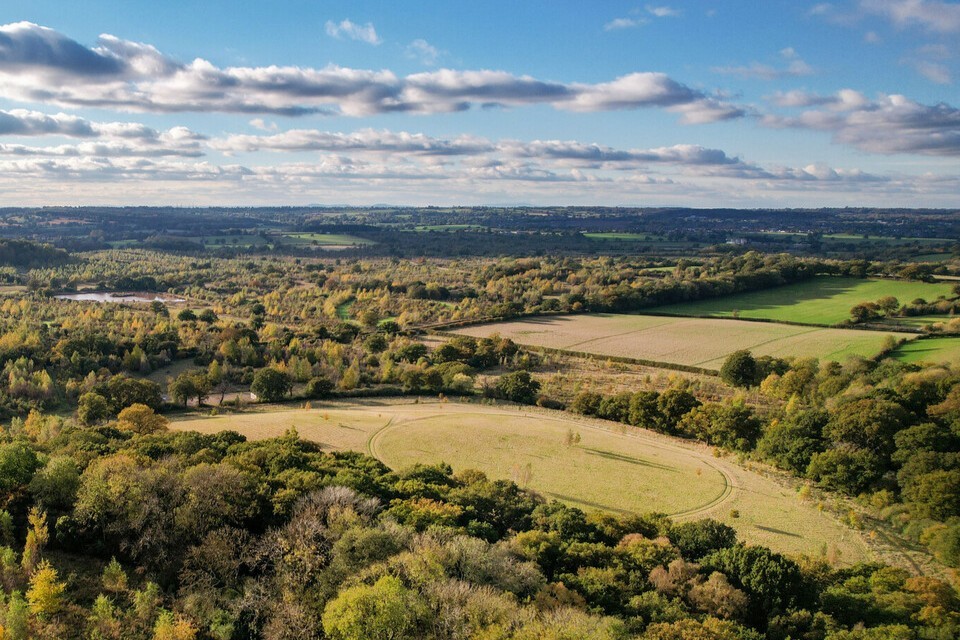
Aerial view of Alne Wood Park showing the burial ground and surrounding woodland.
“I decided to go with the combination of Pear Technology and Edge IT’s Epitaph software as they had a proven track record of working with Natural Burial Grounds. Pear offered the combination of the practical surveying and mapping on the ground to create a digital map that is also synced with the record keeping capabilities of Epitaph.”
The Solution: A Seamless Digital Integration
The original surveyed site layout of the burial ground was based upon a grid of 30 metre squares. Pear uploaded this plan onto our high accuracy GPS equipment and visited Alne Wood to record the corners of each 30m square on the ground. These locations were physically marked with in-the-ground metal survey markers. These fixed points allow James to accurately measure out a plot location when on site, using these as reference to mark the corners of each square. A consistent direction of measurement is used to ensure any small errors inherent in the process are consistent and not compounded.
Pear also captured the location of existing burials and trees using the GPS equipment so these could be accurately mapped on the new plot layout. As there had not been a formalised process before, a number of the existing graves did not accurately follow the grid, these inconsistencies were captured using Pear’s GPS equipment and are indicated on the map. This has allowed the layout to be created that accommodates these and leaves areas around them to ensure overlap is not possible.
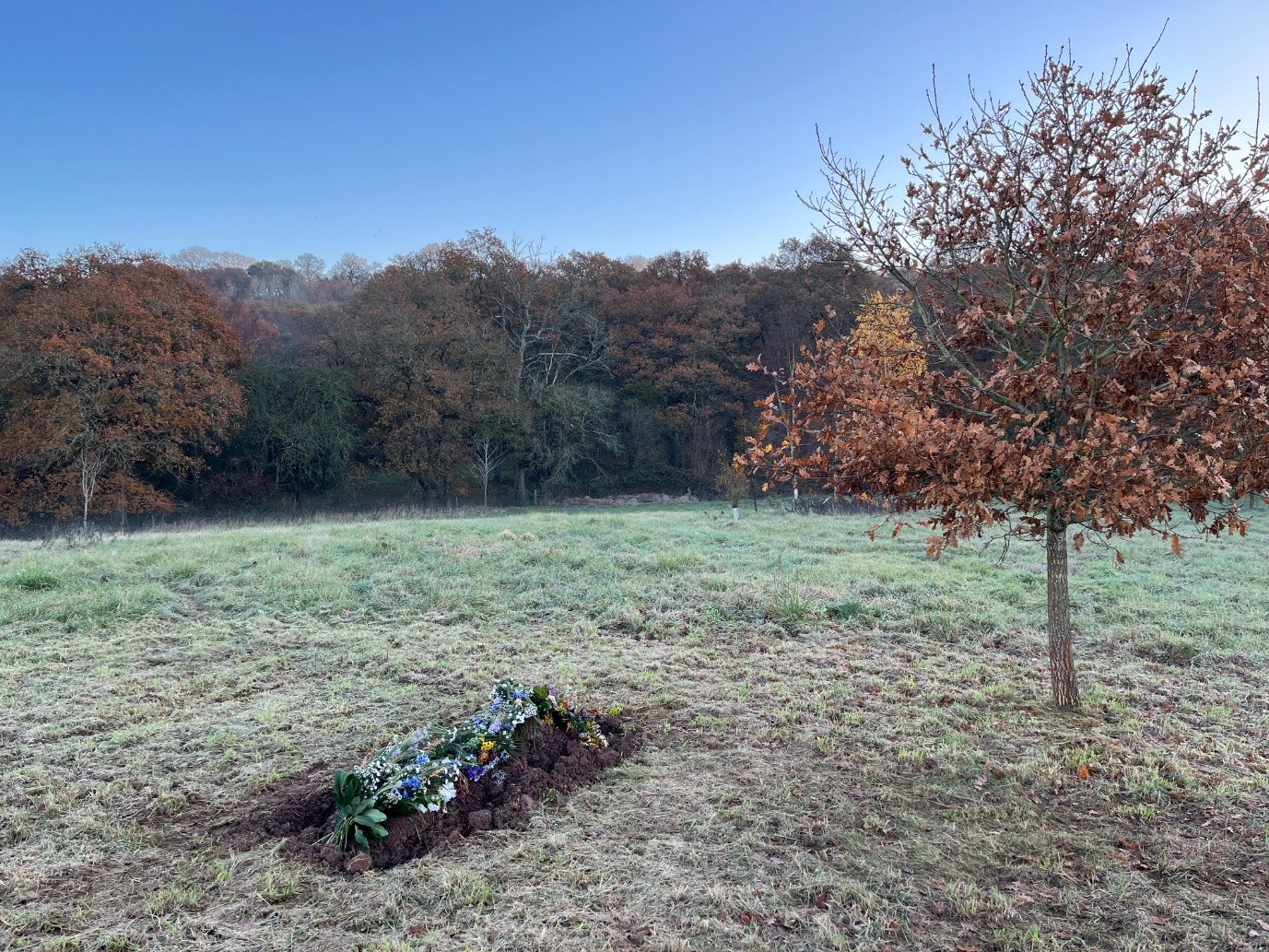
A recent burial: The online map is crucial for people to locate plot locations as plots are only marked at ground level.
“Mapping the site and installing the survey markers took around a day to complete. Given the number of data-points we had to check for existing burial locations, trees and the grid-corners, this was a straightforward process. It was also reassuring to see in real-time on Pear’s high accuracy GPS equipment that the existing map was accurate to what was on the ground.”
Meanwhile, Edge IT System’s Epitaph burial administration system was populated with the burial records from the original spreadsheets. Pear and Edge worked together to implement the existing plot-number format to ensure a smooth linking process between the two.
When back in the office, Pear then plotted and numbered the existing and potential full-burial and cremation plots. It was important to retain the ability to keep options for both in unused areas to allow for future flexibility of layout. Given the space there are over 10,000 potential plots when all options are combined, however in reality far fewer will be used to allow for access and future planting on the site. In areas already containing burials Pear adapted the new layout to avoid any overlapping of plots.
James worked with Pear staff to create a layout showing used plots, pre-reserved plots, available plots, plots that will not be available for years to come and plots unavailable due to the track or existing trees.
“Finalising the map was an iterative process as we were working with existing plots and trying to think about how best to layout plots for future use”, James explains, “Pear were patient and accommodating during this, offering suggestions and allowing us to end up with a system that worked now but also kept maximum flexibility for the future”.
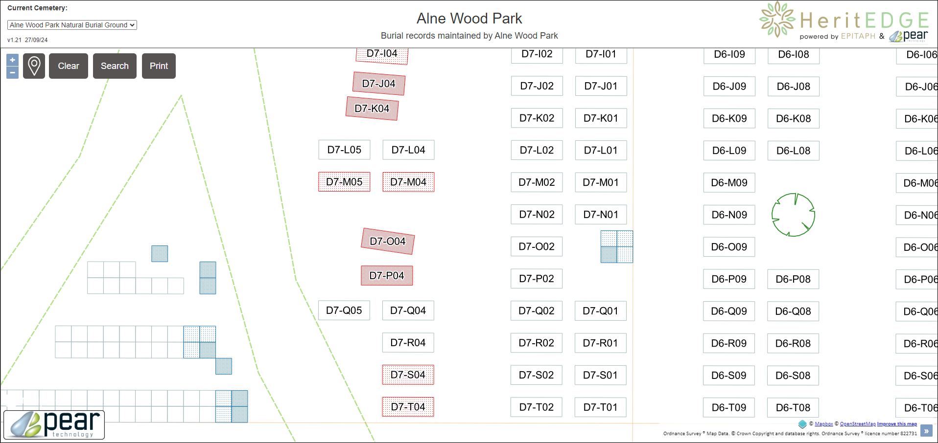
Map Detail showing plots styled to show availability.
The Results: Enhanced Efficiency and Visitor Experience
Pear styled the online map to show these in different colours and hide the plots that are not currently available for purchase. This helps to make the site more manageable as plots are easily identified and the map is not too busy. It is still possible to record information about the hidden plots in the Epitaph records and these can be made visible easily, if it becomes necessary.
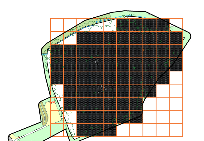
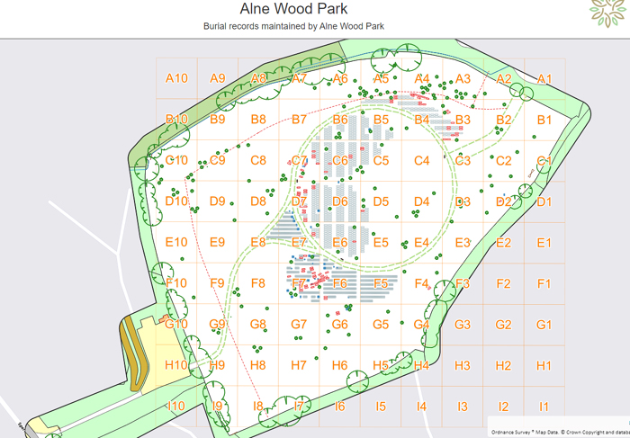
Comparison showing all the plots held in PearGIS (left) and what the end user sees in HeritEDGE (right).
Records are immediately updated on the map as they are changed by James using the Epitaph software.
Pear Technology’s map maintenance service enables the map styling to be updated whenever the Natural Burial Ground requires. Other features, such as trees and benches can be added or removed and other amendments to the layout made.
Alne Wood now has an interactive online natural burial ground map and management system, which can meet the business and management needs of the burial ground, as it continues to develop.
“One of the most important jobs for a burial ground is accurate mapping and robust record keeping. The combination of Pear Technology and Edge IT’s solution has allowed us to be confident in how we are doing this. In turn this ensures the people using the burial ground can trust the ongoing reliability and maintenance of this information.”
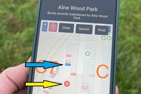
The requested grave
The location of the user indicated by red dot on the map
The map can be accessed onsite using a smartphone. The GPS location tool helps locate loved ones plot locations.
The interactive online natural burial ground map is shared with the public via a page on the burial ground’s website explaining how to use the GPS on a phone with the map to locate and navigate to a grave location while visiting: https://www.alnewoodpark.co.uk/locating-grave-alne-wood-park
“We’ve continued to work with Pear over the course of the year to make adjustments and have added a few more trees which we positioned using the map. We’ve also added a Muslim section to the site with plots positioned facing Qibla (Mecca) with Pear’s help in marking out the plots in the correct direction.”


