
Public Rights of Way data now available for the majority of the UK
Public Rights of Way data has recently become much more widely available and Pear Technology are pleased to offer the service of adding this information to your digital map.
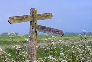
Available on various Ordnance Survey raster tiles, Public Rights of Way information previously had to be purchased then painstakingly traced leaving some degree of inaccuracy. It can now be added to your digital map on its own layer, making it much easier to display and edit on your map. In PT-Mapper Pro, one click can tell you how long the footpath is and another can show you the route in Google Earth’s aerial view.

Subject to the data availability, we can provide you with a layer for each classification of the Public Rights of Way. These are:
- Footpaths – for walking, running or mobility vehicles.
- Bridleways – for walking, horse riding, cycling or mobility vehicles.
- Restricted Byways – for any transport without a motor and mobility vehicles.
- Byways Open to All Traffic (BOAT) – for any kind of transport, including cars but mainly used by walkers, cyclists and horse riders.
Landowners have responsibilities for the Rights of Way which fall on their land. Knowing where these routes are is the first step in ensuring compliance with environmental law!
Did you know?
- You are not allowed to grow crops on Public Rights of Way, although grass can be grown for hay and silage.
- Footpaths and Bridleways may not be ploughed unless they cross fields. Landowners must then supply an access route 1m – 2m wide respectively within 14 days of ploughing.
- You cannot put up gates or stiles without the local authorities permission.
If you would like Public Rights of Way information added to your map simply email info@peartechnology.co.uk or call us on 02392 499689 and we can check availability and provide a quote for the work.


